
We are very blessed with hikes and trails of varying difficulty and unique beauty.
 Scrambles have become quite popular over the past several years. Brett Pawlyk has written a book about Scrambles in David Thompson Country and has graciously shared the following excerpt with us.
The complete book with descriptions and maps of many scrambles can be purchased at https://dtcountryscrambles.wixsite.com/guidebook
Scrambling in David Thompson Country
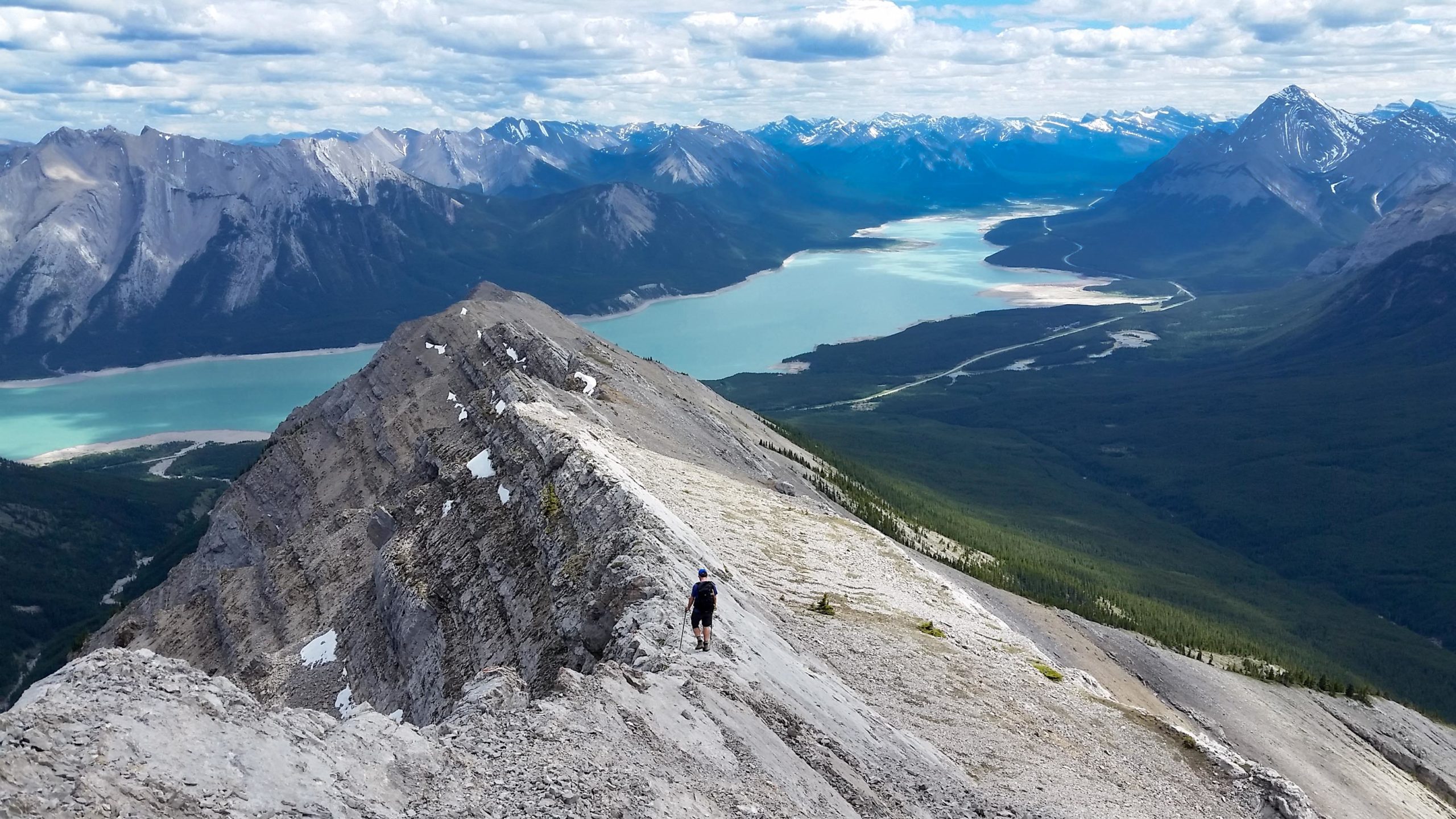
While Banff and Jasper draw most of the visitors to the Canadian Rockies, there is an underrated place which continually flies under the radar – a place called David Thompson Country in Alberta. What does this mean for scramblers? It means an area of mountains that is minimally developed, with few trails, almost no signage and summers full of adventurous scrambles for those seeking such a flavour. Highway 11 cuts right through the middle of the North Saskatchewan River valley, giving scramblers access to a myriad of ridges and peaks. Days can be spent navigating through open forests, scrambling up open limestone ridges, skiing down scree slopes and fording snow fed creeks. Nothing beats catching a snooze on a summit on that rare windless day, all while seeing more bighorn sheep than people. David Thompson Country is special. You may not be able to remember what you were doing last week but adventures in this area will be recalled years from now.
Scrambling in David Thompson Country demands a high skill set from those who venture into this area. With a lack of trails, signs and cell coverage, self-reliance and a sense for adventure are key. This guidebook is designed to keep the adventurous spirit of David Thompson the explorer, and the wild country that is named after him, intact. In this book you will find scrambling routes with pictures that show known ascent and descent routes, general difficulty ratings, times and a brief written description of the routes along with any major obstacles/difficulties to be found en route. You will not find GPS tracks, step by step instructions or how to scramble tutorials. This book arms the reader with enough information to pull off a successful scramble, while still leaving the thrill of discovery and the excitement of the unknown intact. After all, isn’t a summit much more fulfilling and memorable when effort is put into the journey? A certain degree of responsibility is on the scrambler to gather more information if needed and to incorporate their own preparation, judgement, and decision-making skills into their journey. Planning and executing a successful scramble creates a feeling like no other.
I hope this book inspires you. Get out more, get your hands dirty, wear down the soles of your boots and stoke that need for adventure. May your forays into David Thompson Country nourish the soul!
Allstones Ridge
Trip Time: 3 to 7 hrs
Level of Difficulty: easy navigation, easy scrambling
Elevation Gain: 748m
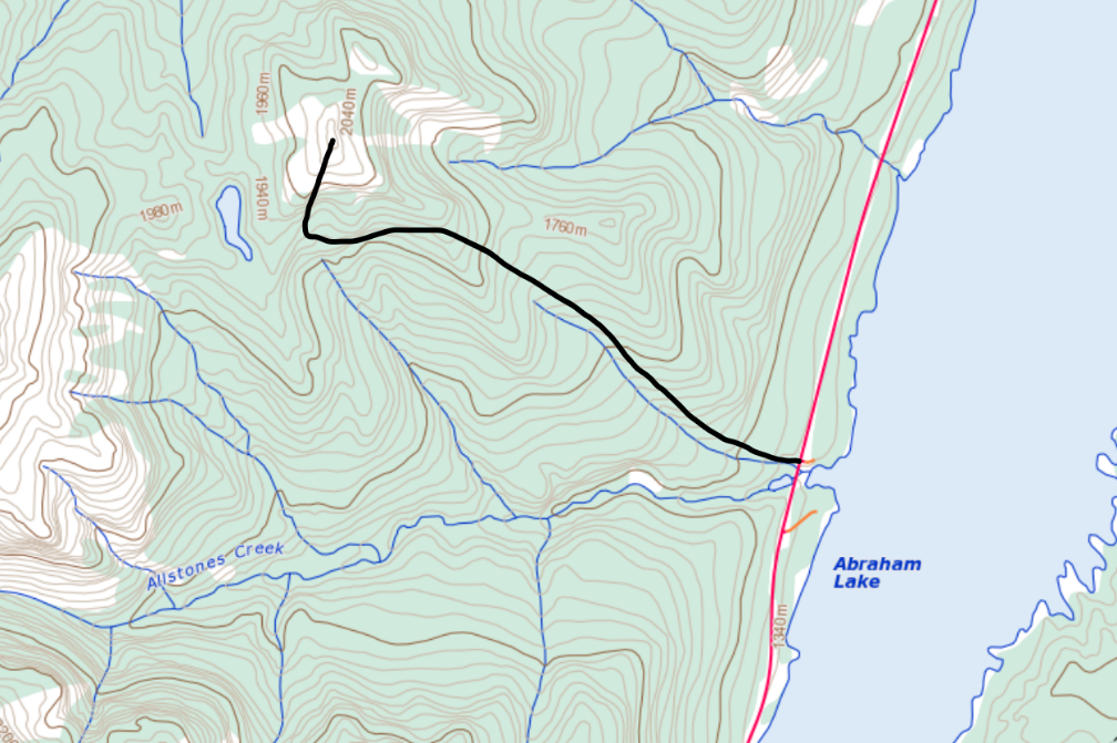
Access: Allstones Creek trailhead at Allstones Creek (sign on highway
Opinion: This is the easiest scrambling route in DT country and is perfect to do as your first scramble. A well-defined trail gets you to the alpine and very easy scrambling over shale and rock ribs gets you to the top. Abraham Reservoir and the Windy Ridge massif create a great panoramic view! There is also a lake to visit on the way down for a refreshing swim after all the hard work. Whether you are scrambling for the first time or you are a seasoned peak bagger, this is an all-around fun day out.
Description: There are two parking spots for this route, one on the north side of Allstones Creek and one on the south, which has an outhouse and more room for parking. The trail starts out across the highway from the north lot and begins climbing through dense forest. It starts off steep and gets the legs warmed up for the rest of the day. As the trail levels out a little, you will cross a small, bridged creek and then begin a series of steep sections. Due to the traffic on this trail, the steep sections have some erosion issues, which make for some tricky footing – stay alert! The forest begins to open up and soon the steep trail starts to level out and traverses the shoulder of Allstones Ridge. You will cross open avalanche slopes, which make for beautiful flowering meadows in the summer and big views out to the reservoir.

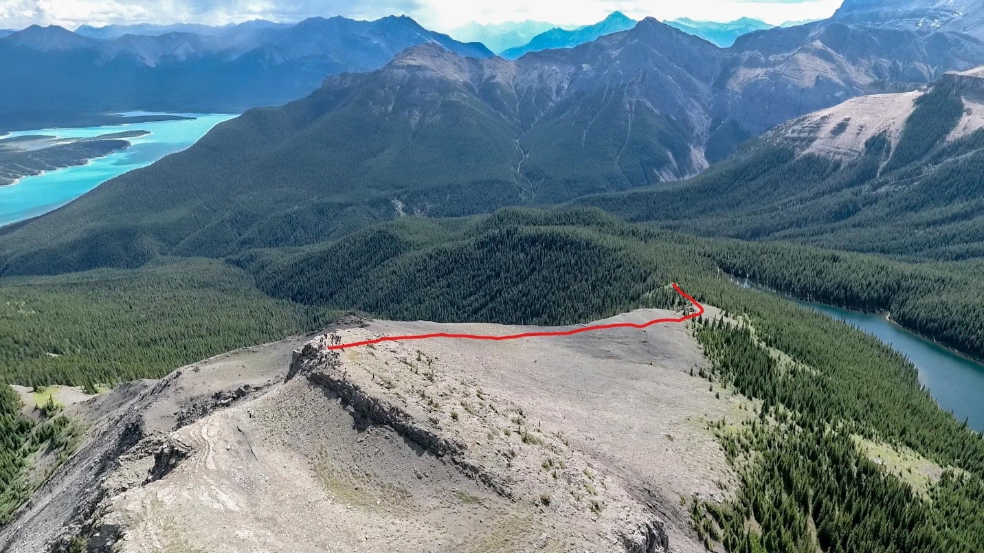
Continue traversing over rolling terrain until the trail enters the forest and begins to drop towards the lake. Instead of going down, keep an eye out on your right for the trail that leads to the peak. Work your way up through the forest for a short time and pop out onto the open ridge. From here you can see your destination and the route you will take to get there.
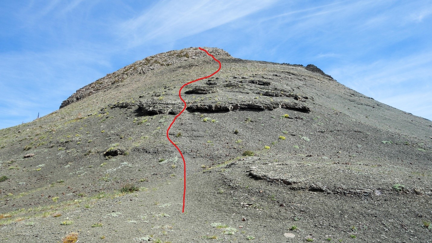
Continue up the shale ridge, picking your way carefully over the steep sections that contain lots of loose gravel sitting on top of the hard shale. It is very easy to slip on these sections. Eventually you will get to the summit block, which consists of big, blocky loose rocks and solid ribs. You have the option of multiple routes, some easy and some with some hands-on sections. Choose your own adventure to the top and enjoy the expansive views in all directions and Allstones Lake below!

Descent: Return the way you came. Be careful on the loose sections as many experienced scramblers have been caught off guard here. When you get to the intersection with the main trail, the lake is five minutes down to the right and is worth a stop for a refreshing swim on a hot day. There are also outhouses located by the camping area – keep an eye out for the sign. If you are returning to your car, take a left and head back down the mountain.
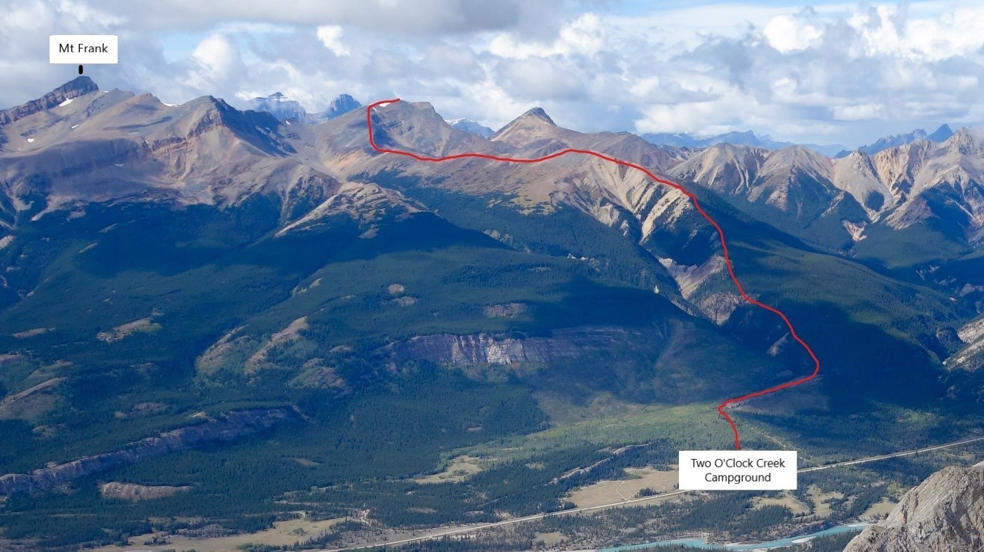
2 O’Clock Ridge to Summit
Trip Time: 6 to 10 hrs
Level of Difficulty: easy navigation, easy scrambling
Elevation Gain: 1440m
Access: 2 O’Clock Creek campground
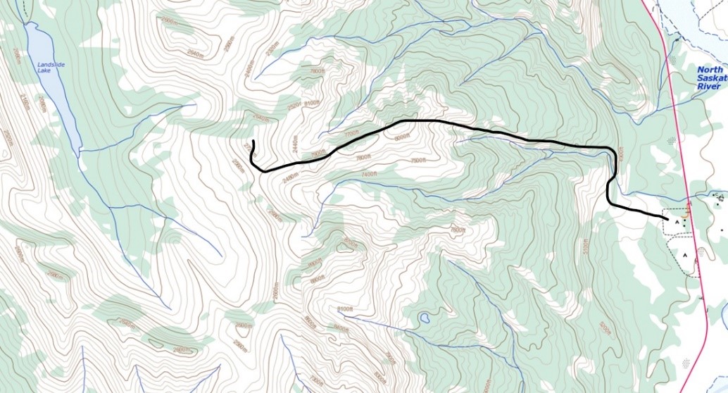
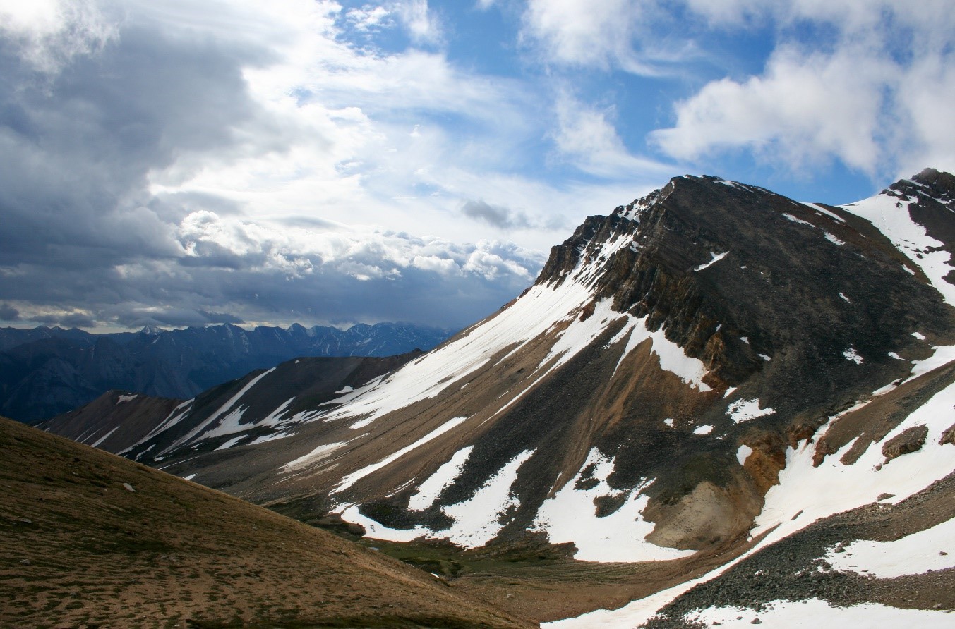
Opinion: This is a big day that has a mix of trail and easy route finding. It ends at a high summit overlooking Landslide Lake and expansive views of the North Saskatchewan River valley. This is a great option for someone who is ready to up their distance, elevation and make a foray into scrambling off route. The views are hard to beat!
Route Description: Park at the campground and follow the trail that heads west towards the mountain between campsite 6 and the outhouse. The creek will be on your right (north) as you make your way up. If you encounter any forks in the trail, stay to the right. You will enter an old forest fire area and this is where the trail crosses the creek. Gain an open, burned ridge to get your first views of the area. Stay on the trail as it enters forest with intermittent views of the creek on your left. Follow the trail for a long way up through patches of exposed meadow and eventually out onto an open, grassy knob. From here the trail becomes more indistinct as it enters the talus. Continue to go west towards the rounded peak in the back. Check the skies for signs of thunderstorms before you commit to the summit. It is exposed and far away.
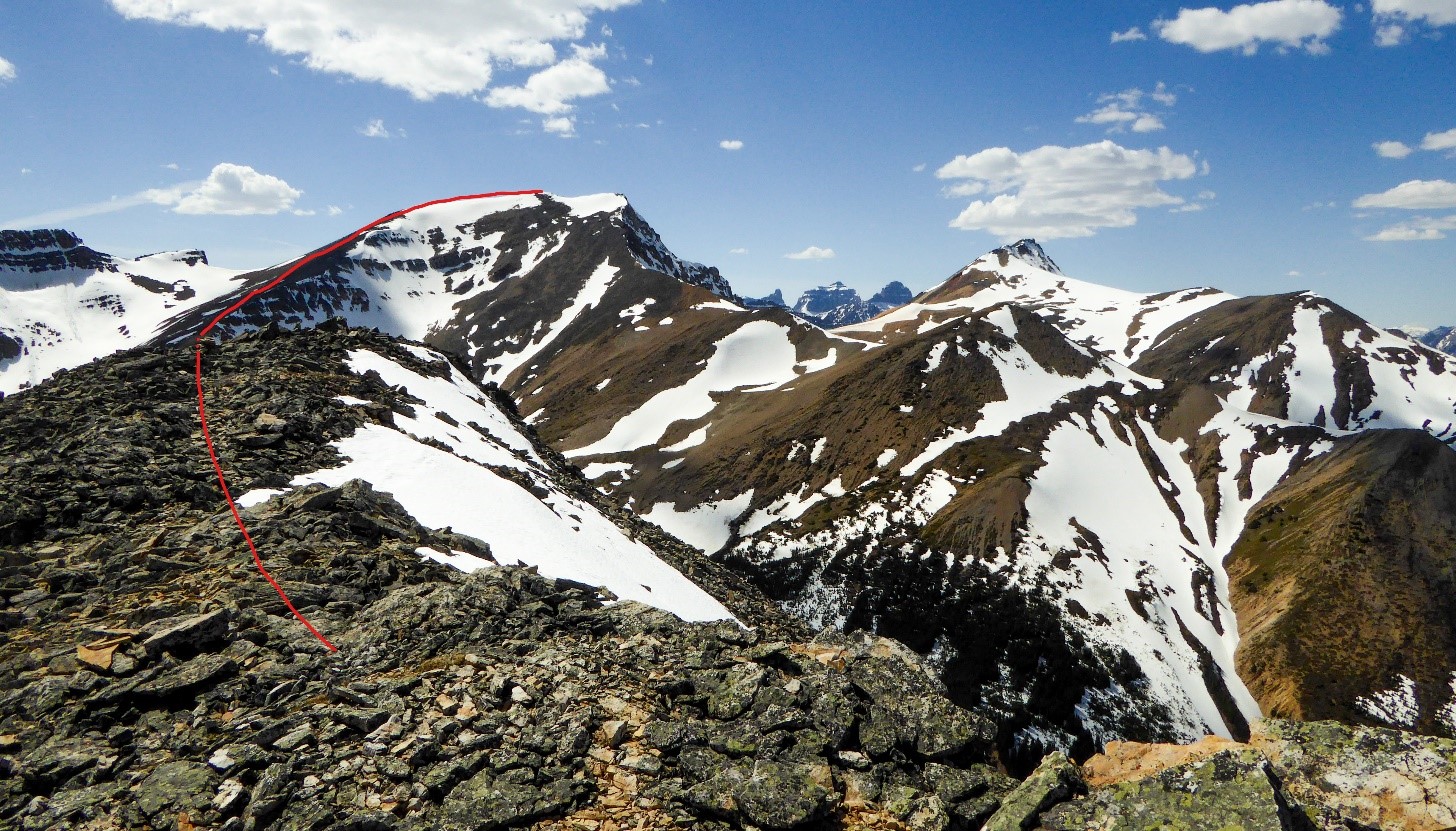
You will cross over multiple humps as you make your way towards the summit. You can either go up and over each one or skirt the shoulders on the left to save elevation gain and loss. Once you get to the main shoulder the rocks get larger and more multi-coloured. Be aware that these rocks are sometimes loose and can surprise the unsuspecting. Choose the easiest route to the top.
Descent: Return the way you came. Attempting to drop off early, left or right, will lead to terrain problems.
Other Blog Articles
Explore David Thompson Country
-
September 13, 2017
3 More Incredible Hikes in David Thompson Country
3 unique and unforgettable hikes to explore in David Thompson Country. Experience the best trails in west Central Alberta.
-
August 30, 2019
13 Summer Adventure Pictures in David Thompson Country – August 30, 2019
It was a wet year and we didn’t see many hot days, but the views were still wonderful, the hikes amazing, and the camping always fun. Here are some of our favorite summer adventures in David Thompson Country for 2019. Whitewater Rafting with Hunter Valley Adventures on the Red Deer River in the southern […]
-
July 20, 2020
Scrambles around Nordegg and Abraham Lake in David Thompson Country
We are very blessed with hikes and trails of varying difficulty and unique beauty. Scrambles have become quite popular over the past several years. Brett Pawlyk has written a book about Scrambles in David Thompson Country and has graciously shared the following excerpt with us. The complete book with descriptions and maps of many scrambles […]